 Meadowbrook
Address in.
Sheet out.
Type an address; the sheet fills itself. Instant yard measurement for service businesses in St. Tammany Parish: the mowable yard on the customer's own aerial photo, everything you don't bill shaded out. No site visit, no callback, no guessing from the truck.
3 free lookups, no card. Your sheet appears on the next page.
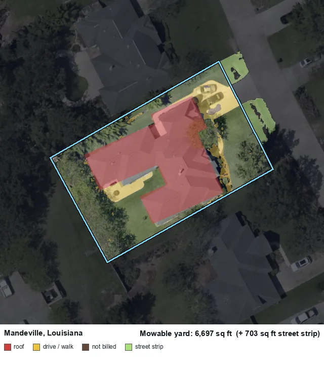
Boundary checked against the assessor's own recorded lot area.
From address to sheet
Any residential address in St. Tammany Parish.
The property line from parish records, the yard from official aerial data, the street strip along the road on its own line. Seconds, not site visits.
Your eye knows the yards you mow. Fix anything the photo got wrong, download the image, quote with it.
Use it your way
Look up properties right here: see the sheet, edit it, export it. Nothing to install.
An API key comes with every plan. Address in, numbers and the marked-up image out.
Connect an assistant via MCP and ask it for measurements. Results link back here for edits.
Build your plan. From $29.99 a month.

Built and answered by Thomas Mundle in Covington, Louisiana. Your questions land with the founder, not a ticket queue - usually answered the same day.
Don't want to use our interface or page? We can integrate it on your site: your branding, your pricing, quotes emailed straight to you. Ask about done-for-you setup.
The terms, up front
Every number is an estimate from the best data available and the capabilities of our measurement model. It is a starting point for professional judgment, not a survey.
Estimates are measured from official aerial imagery and elevation data captured 2019-2021 (most areas 2021). Homes built or substantially changed since then are flagged or refused, never silently measured.
Where a property can't be measured honestly, deep tree cover, no usable address, a data gap, the tool refuses with a reason instead of guessing. A refusal means someone looks, once.